Pioneer AVIC-D1 Owner's Manual - Page 125
Route highlighting, Inter enlargement, Tracking
 |
UPC - 012562739496
View all Pioneer AVIC-D1 manuals
Add to My Manuals
Save this manual to your list of manuals |
Page 125 highlights
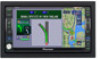
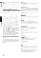
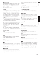
NAVI/AV Appendix • In some cases, guidance may direct you past your destination and then indicate a U-turn to get back to it. • In some cases, a route may begin on the opposite side of a railway or river from your actual current location. If this happens, drive towards your destination for a while, and try route calculation again. • In the following cases, the route that passes through an Area to Avoid may be set: - when your vehicle is in the Area to Avoid - when your destination or way points are in the Area to Avoid - when it is not possible to avoid doing so • If a suitable route cannot be set in compliance with the specified "Detour" distance, or your preference to avoid freeways, toll roads, ferry route, the setting or parameter may be ignored. • When there is a traffic congestion or closure ahead, if driving through the traffic congestion or closure is better than taking the detour, a detour route may not be set. • There may be instances when the starting point and the destination point are not on the highlighted route. • The number of traffic circle exits displayed on the screen may differ from the actual number of roads. Auto Reroute • Auto Reroute is used when you deviate more than 0.01 mi (30m) from the route. • Auto Reroute function does not work in the fol- lowing cases: - when your vehicle is not on a street - when you are too close to your destination - when your vehicle is on a ferry - when driving on a road inside a facility - when driving on a traffic circle - when the vehicle goes out of the area stored in the disc - when driving on the routes are described in "Roads not used in calculations" Route highlighting • Once set, the route is highlighted in bright green or light blue on the map. • The immediate vicinity of your starting point and destination may not be highlighted, and neither will areas with particularly complex road layouts. Consequently, the route may appear to be cut off on the display, but voice guidance will continue. Roads not used in calculations Even though displayed onscreen, the following roads are not included in route calculations. • Stubble Road • Walk Way • Public vehicle only • Non routable road Intersection enlargement • When "Close-up of Junction" is on, the map scale increases to show more detail as you approach an intersection. • If the intersection is approached in a gentle curve, the map displayed may differ from the actual road layout. Tracking • Your Navigation System marks your course on the map in certain increments. This is called tracking. It is handy when you want to check a route traveled without guidance or if returning along a complex route. • A maximum of about 145 miles (230 km) is marked and, as you travel beyond this limit, tracking marks are erased in order from the most distant. Tracking display shows about 100 miles tracking of your vehicle with white dots. ➲ Tracking can also be set for automatic erasing whenever the Navigation System is switched off ➞ Page 65 123
-
 1
1 -
2
-
3
-
4
-
5
-
6
-
7
-
8
-
9
-
10
-
11
-
12
-
13
-
14
-
15
-
16
-
17
-
18
-
19
-
20
-
21
-
22
-
23
-
24
-
25
-
26
-
27
-
28
-
29
-
30
-
31
-
32
-
33
-
34
-
35
-
36
-
37
-
38
-
39
-
40
-
41
-
42
-
43
-
44
-
45
-
46
-
47
-
48
-
49
-
50
-
51
-
52
-
53
-
54
-
55
-
56
-
57
-
58
-
59
-
60
-
61
-
62
-
63
-
64
-
65
-
66
-
67
-
68
-
69
-
70
-
71
-
72
-
73
-
74
-
75
-
76
-
77
-
78
-
79
-
80
-
81
-
82
-
83
-
84
-
85
-
86
-
87
-
88
-
89
-
90
-
91
-
92
-
93
-
94
-
95
-
96
-
97
-
98
-
99
-
100
-
101
-
102
-
103
-
104
-
105
-
106
-
107
-
108
-
109
-
110
-
111
-
112
-
113
-
114
-
115
-
116
-
117
-
118
-
119
-
 120
120 -
 121
121 -
 122
122 -
 123
123 -
 124
124 -
 125
125 -
 126
126 -
 127
127 -
 128
128 -
 129
129 -
 130
130 -
131
-
132
-
133
 |
 |
