Garmin GPS 152 Owner's Manual - Page 28
Map - update
 |
UPC - 753759028145
View all Garmin GPS 152 manuals
Add to My Manuals
Save this manual to your list of manuals |
Page 28 highlights
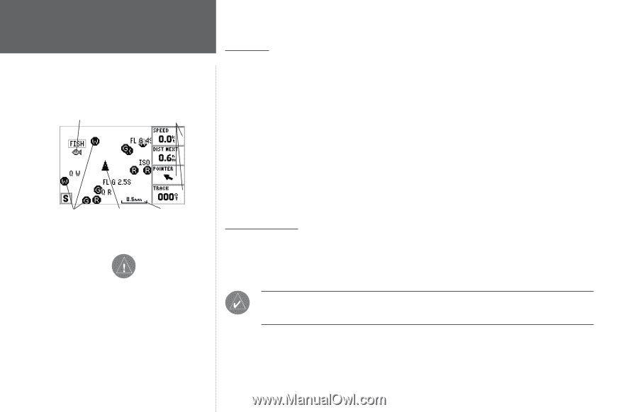
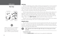
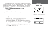
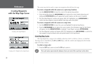
Reference Map Page User Waypoint Data Fields Navaids Boat Icon Map Scale , If MapSource Points of Interest or other MapSource data is loaded into the unit, the tides, cities and marine navaids will be deleted from the system. Check the GARMIN web site (www.garmin.com) for updates to reinstall the original factory-loaded data. 18 Map Page The GPS 152's Map Page provides a display of plotting and navigational data. The unit is preloaded from the factory with a worldwide database of cities greater than 200,000 in population and marine navaids, for the Americas only. It also plots your track and displays any routes and waypoints you create. An on-screen cursor lets you pan and scroll to other map areas, determine the distance and bearing to a position, and perform various route and waypoint functions. Two basic map operating modes, position mode and cursor mode, determine what is shown on the map display. Position mode pans the map to keep the present position marker (triangle) within the display area, while cursor mode pans the map to keep the cursor (arrow pointer) within the display area. The GPS 152 will always power up in the position mode, with your vessel centered on the map display. Whenever the ARROW KEYPAD is pressed, the GPS 152 will enter cursor mode. When the cursor is active, an additional data window will appear at the top of the screen to indicate the position, range and bearing to the cursor or a selected waypoint or map item. Using the Cursor The cursor allows you to pan away from your present position and scroll to other map areas around the world. As you pan past the edge of the current map display, the screen will actively scroll forward to provide continuous map coverage (keep in mind that the boat icon will move with the scrolling map, and may not be visible on the display screen). ) NOTE: When the cursor reaches the edge of the map, the unit may pause as it loads new data. To move the cursor: 1. Press the ARROW KEYPAD to move the cursor in an up, down, left or right direction.
-
 1
1 -
2
-
3
-
4
-
5
-
6
-
7
-
8
-
9
-
10
-
11
-
12
-
13
-
14
-
15
-
16
-
17
-
18
-
19
-
20
-
21
-
22
-
 23
23 -
 24
24 -
 25
25 -
 26
26 -
 27
27 -
 28
28 -
 29
29 -
 30
30 -
 31
31 -
 32
32 -
 33
33 -
34
-
35
-
36
-
37
-
38
-
39
-
40
-
41
-
42
-
43
-
44
-
45
-
46
-
47
-
48
-
49
-
50
-
51
-
52
-
53
-
54
-
55
-
56
-
57
-
58
-
59
-
60
-
61
-
62
-
63
-
64
-
65
-
66
-
67
-
68
-
69
-
70
-
71
-
72
-
73
-
74
-
75
-
76
-
77
-
78
-
79
-
80
-
81
-
82
-
83
-
84
-
85
-
86
-
87
-
88
-
89
-
90
-
91
-
92
-
93
-
94
-
95
-
96
-
97
-
98
 |
 |