Garmin GPS 152 Owner's Manual - Page 35
General Tab, Source Tab, Points Tab
 |
UPC - 753759028145
View all Garmin GPS 152 manuals
Add to My Manuals
Save this manual to your list of manuals |
Page 35 highlights
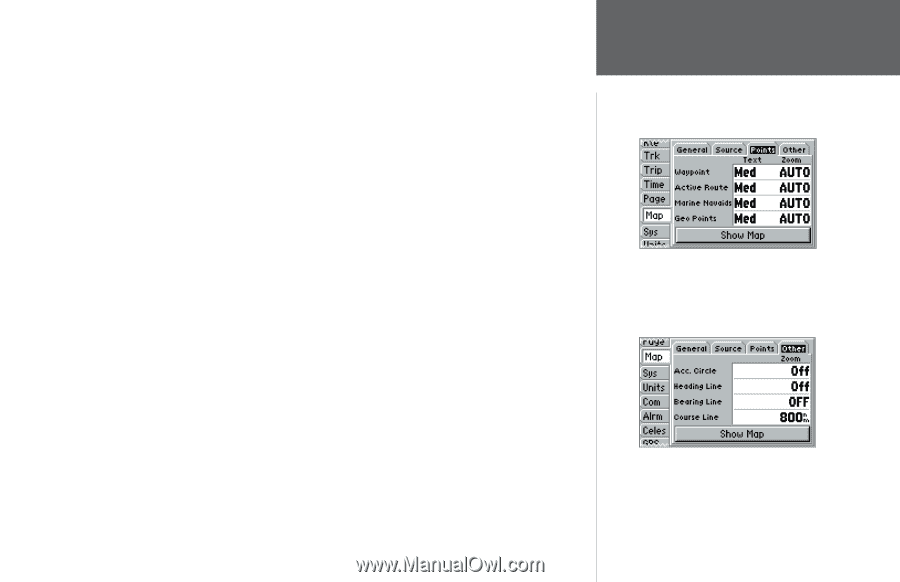
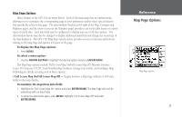
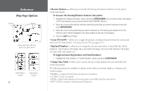
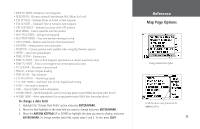
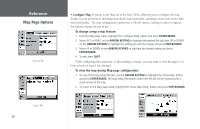
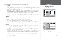
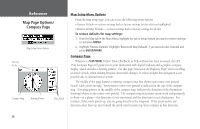
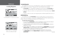
Following are details on each of the settings in the Map setup file tabs: General Tab Detail - Most, More, Normal, Less, Least: controls how much map detail you will see. This setting only applies to any map feature set to "Auto." Those features which have a specified scale or are turned "Off" are unaffected by this setting. Orientation - North Up: fixes the top of the map display to a north heading; Track Up: fixes the top of the map display to the current track heading; Course Up: fixes the map so the direction of navigation is always "up" and turns the navigation leg line vertical on the screen. AutoZoom - On/Off: when "On" the map will automatically adjust the map scale to a lower scale as you approach you destination point. Source Tab Data - On/Off: turns the loaded map data on or off. Points Tab - Waypoints, Active Route, Marine Navaids, and Geo Points Text - None, Small, Medium, and Large: controls the screen size of the name. Zoom - Auto, Off, 120 ft.-800 mi.: sets the maximum scale at which the feature should appear on the screen. Some types of data will only show up to certain zoom scales. Other Tab Accuracy Circle - On/Off: toggles the circle "On" or "Off." The circle represents the approximate accuracy of the unit based on EPE and DOP. Your position will be within the circle. Heading Line - On/Off: turns the Heading Line "On" or "Off. The Heading Line projects from the triangle (boat icon) showing your current heading. Bearing Line - Auto, Off, 120 ft.-800 mi.: sets the scale at which the Bearing Line will appear on the screen. The Bearing Line shows the bearing from your current location to a destination waypoint. Course Line - Auto, Off, 120 ft.-800 mi.: sets the scale at which the Course Line will appear on the screen. The Course Line shows a direct navigation line from the point navigation was initiated to a destination waypoint. Reference Map Page Options Points Tab Other Tab 25
-
 1
1 -
2
-
3
-
4
-
5
-
6
-
7
-
8
-
9
-
10
-
11
-
12
-
13
-
14
-
15
-
16
-
17
-
18
-
19
-
20
-
21
-
22
-
23
-
24
-
25
-
26
-
27
-
28
-
29
-
 30
30 -
 31
31 -
 32
32 -
 33
33 -
 34
34 -
 35
35 -
 36
36 -
 37
37 -
 38
38 -
 39
39 -
 40
40 -
41
-
42
-
43
-
44
-
45
-
46
-
47
-
48
-
49
-
50
-
51
-
52
-
53
-
54
-
55
-
56
-
57
-
58
-
59
-
60
-
61
-
62
-
63
-
64
-
65
-
66
-
67
-
68
-
69
-
70
-
71
-
72
-
73
-
74
-
75
-
76
-
77
-
78
-
79
-
80
-
81
-
82
-
83
-
84
-
85
-
86
-
87
-
88
-
89
-
90
-
91
-
92
-
93
-
94
-
95
-
96
-
97
-
98
 |
 |