Garmin GPSMAP 740/740s Owner's Manual - Page 11
Viewing Tide Station Information, Charts, Navigation Chart, Fishing Chart, Review
 |
View all Garmin GPSMAP 740/740s manuals
Add to My Manuals
Save this manual to your list of manuals |
Page 11 highlights
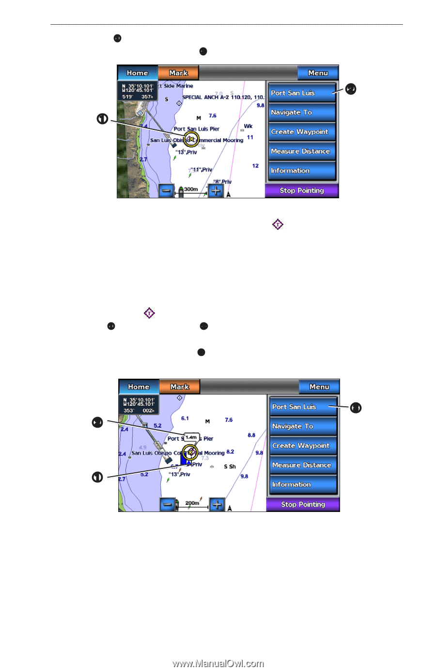
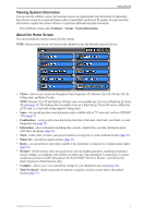
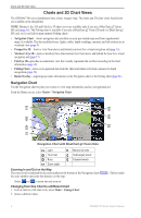
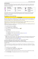
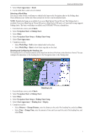
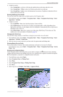
3. Touch an object ➊. 4. Select the button with the name of the item ➋ to view the information. ➊ Charts and 3D Chart Views ➋ Viewing Tide Station Information Tide-station information appears on the chart with a tide station icon ( ). You can view a detailed graph for a tide station to help predict the tide level at different times or on different days (page 36). Note: Tide station icons are available only if you use a BlueChart g2 Vision SD card (page 16). The Fishing chart is available if you use a BlueChart g2 Vision SD card or a BlueChart g2 SD card, or if your built-in map supports Fishing charts. 1. From the Home screen, select Charts. 2. Select Navigation Chart or Fishing Chart. 3. Select a tide station icon ( ). Tide direction ➊ and tide level information ➋ appear near the icon. 4. Complete an action: • Select the button with the station name ➌. • Select Review if more than one item is in the vicinity, and select the button with the station name. ➌ ➋ ➊ GPSMAP 700 Series Owner's Manual 7
-
 1
1 -
2
-
3
-
4
-
5
-
 6
6 -
 7
7 -
 8
8 -
 9
9 -
 10
10 -
 11
11 -
 12
12 -
 13
13 -
 14
14 -
 15
15 -
 16
16 -
17
-
18
-
19
-
20
-
21
-
22
-
23
-
24
-
25
-
26
-
27
-
28
-
29
-
30
-
31
-
32
-
33
-
34
-
35
-
36
-
37
-
38
-
39
-
40
-
41
-
42
-
43
-
44
-
45
-
46
-
47
-
48
-
49
-
50
-
51
-
52
-
53
-
54
-
55
-
56
-
57
-
58
-
59
-
60
-
61
-
62
-
63
-
64
-
65
-
66
-
67
-
68
-
69
-
70
-
71
-
72
-
73
-
74
-
75
-
76
-
77
-
78
-
79
-
80
-
81
-
82
-
83
-
84
-
85
-
86
-
87
-
88
-
89
-
90
-
91
-
92
-
93
-
94
-
95
-
96
-
97
-
98
-
99
-
100
 |
 |