Samsung SGH-T839 User Manual (user Manual) (ver.f9) (English) - Page 148
Settings, Location and security, Use wireless networks, Agree, Use GPS satellites, Use sensor aiding
 |
View all Samsung SGH-T839 manuals
Add to My Manuals
Save this manual to your list of manuals |
Page 148 highlights
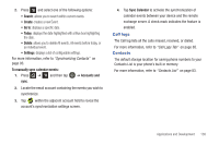
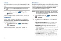
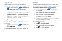
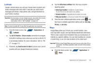
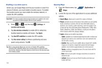
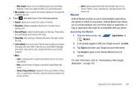
Enabling a Location source Before you use Google Maps and find your location or search for places of interest, you must enable a location source. To enable the location source you must enable the wireless network, or enable the GPS satellites. Important!: The more location determining functions are enabled, the more accurate the determination will be of your position. 1. Press ➔ and then tap Location and security. (Settings) ➔ 2. Tap Use wireless networks to enable GPS to determine location based on nearby cell towers. Tap Agree. 3. Tap Use GPS satellites to enable the GPS satellite. 4. Tap Use sensor aiding to enhance positioning and save power using sensors. Tap OK. Tip: When using Google Maps you can turn on Enable GPS satellites. Selecting GPS satellites allows you to locate places of interest at the street-level. However, this also requires a clear view of the sky and uses more battery power. 143 Opening Maps 1. From the Home screen, tap APPS (Applications) ➔ (Maps). 2. Locate the top row of the applications to access additional options: • Search Maps: allows you to search for a place of interest. • Places: provides access to the places menu where you can quickly locate a business or person, find out more information about a business, see coupons, public responses, and more (ppage 153). Locate and tap one of the listed places (Restaurants, Coffee, Bars, Hotels, Attractions, ATMs, Gas Stations, or Add your own place.) A list of places within this category displays. • Layers: allows you to switch map views: - Traffic: (available only in selected areas) Real-time traffic conditions are displayed over roads as color-coded lines. Each color represents how fast the traffic is moving. - Satellite: Maps uses the same satellite data as Google Earth. Satellite images are not real-time. Google Earth acquires the best imagery available, most of which is approximately one to three years old. - Terrain: combines a topographical view of the area's terrain with the current map location. - Buzz: allows you post public messages and photos at a location for everyone to see. - Latitude: allows you to see your friend's locations and share your location with them.
-
 1
1 -
2
-
3
-
4
-
5
-
6
-
7
-
8
-
9
-
10
-
11
-
12
-
13
-
14
-
15
-
16
-
17
-
18
-
19
-
20
-
21
-
22
-
23
-
24
-
25
-
26
-
27
-
28
-
29
-
30
-
31
-
32
-
33
-
34
-
35
-
36
-
37
-
38
-
39
-
40
-
41
-
42
-
43
-
44
-
45
-
46
-
47
-
48
-
49
-
50
-
51
-
52
-
53
-
54
-
55
-
56
-
57
-
58
-
59
-
60
-
61
-
62
-
63
-
64
-
65
-
66
-
67
-
68
-
69
-
70
-
71
-
72
-
73
-
74
-
75
-
76
-
77
-
78
-
79
-
80
-
81
-
82
-
83
-
84
-
85
-
86
-
87
-
88
-
89
-
90
-
91
-
92
-
93
-
94
-
95
-
96
-
97
-
98
-
99
-
100
-
101
-
102
-
103
-
104
-
105
-
106
-
107
-
108
-
109
-
110
-
111
-
112
-
113
-
114
-
115
-
116
-
117
-
118
-
119
-
120
-
121
-
122
-
123
-
124
-
125
-
126
-
127
-
128
-
129
-
130
-
131
-
132
-
133
-
134
-
135
-
136
-
137
-
138
-
139
-
140
-
141
-
142
-
 143
143 -
 144
144 -
 145
145 -
 146
146 -
 147
147 -
 148
148 -
 149
149 -
 150
150 -
 151
151 -
 152
152 -
 153
153 -
154
-
155
-
156
-
157
-
158
-
159
-
160
-
161
-
162
-
163
-
164
-
165
-
166
-
167
-
168
-
169
-
170
-
171
-
172
-
173
-
174
-
175
-
176
-
177
-
178
-
179
-
180
-
181
-
182
-
183
-
184
-
185
-
186
-
187
-
188
-
189
-
190
-
191
-
192
-
193
-
194
-
195
-
196
-
197
-
198
-
199
-
200
-
201
-
202
-
203
-
204
-
205
-
206
-
207
-
208
-
209
-
210
-
211
-
212
-
213
-
214
-
215
-
216
-
217
-
218
-
219
-
220
-
221
-
222
-
223
-
224
-
225
-
226
-
227
-
228
-
229
-
230
-
231
-
232
-
233
-
234
-
235
-
236
-
237
-
238
-
239
-
240
-
241
-
242
-
243
-
244
-
245
-
246
-
247
-
248
-
249
-
250
-
251
-
252
-
253
-
254
-
255
-
256
-
257
-
258
-
259
 |
 |
