Garmin GPSMAP 6012 Owner's Manual - Page 25
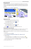
Perspective 3D, Adjusting the View, Viewing Details about Navaids
 |
View all Garmin GPSMAP 6012 manuals
Add to My Manuals
Save this manual to your list of manuals |
Page 25 highlights
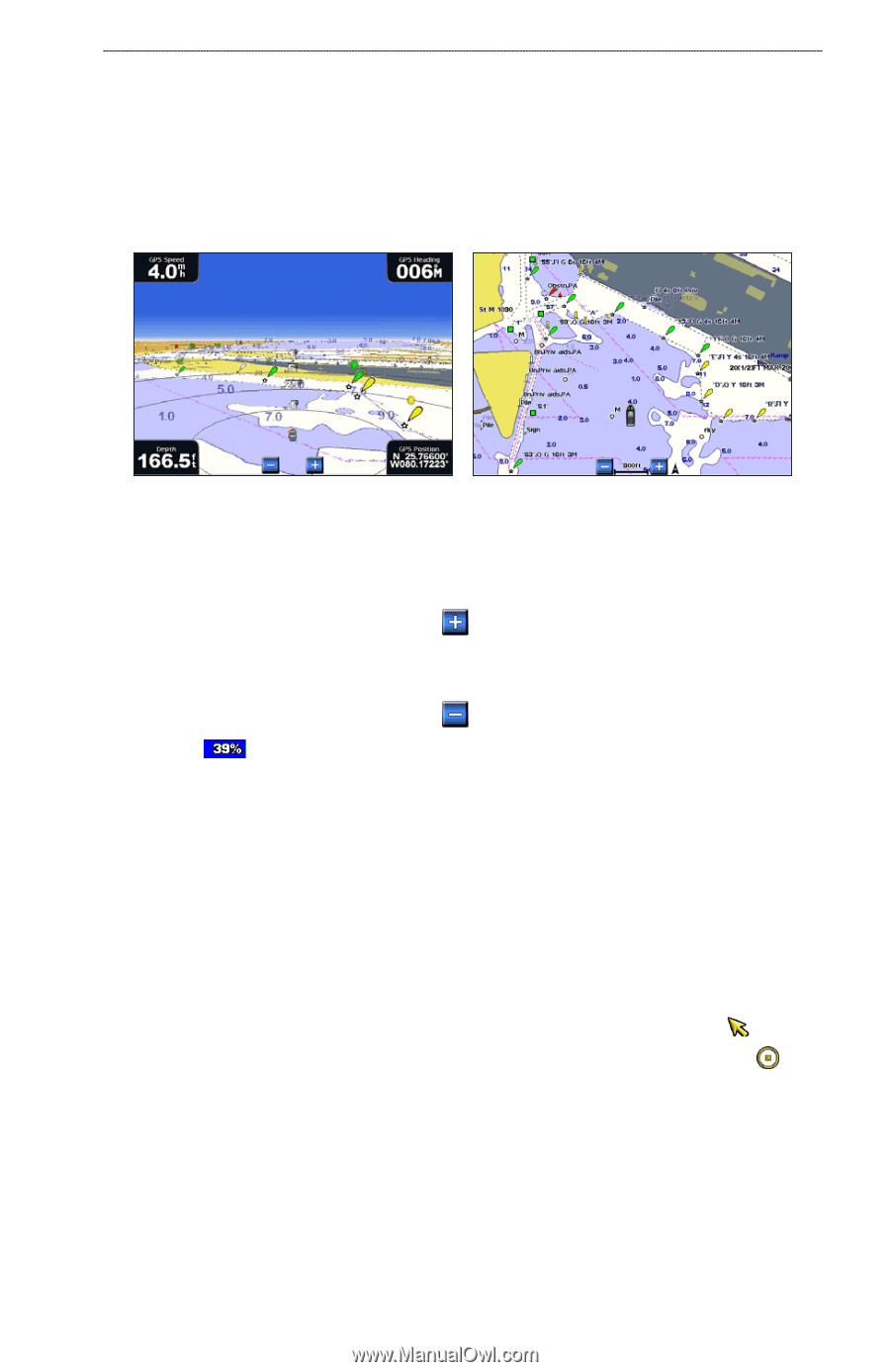
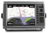
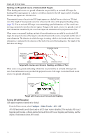
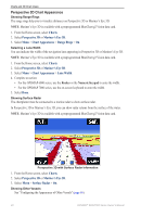
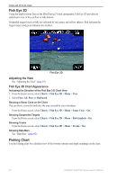
Charts and 3D Chart Views Perspective 3D Perspective 3D provides a view from above and behind the boat (according to your course) and provides a visual navigation aid. This view is helpful when navigating tricky shoals, reefs, bridges, or channels, and is beneficial when trying to identify entry and exit routes in unfamiliar harbors or anchorages. From the Home screen, select Charts > Perspective 3D. Perspective 3D Navigation Chart Adjusting the View • Move the view closer to your boat and lower to the water: ◦ For the GPSMAP 6000 series, press the Range (+) key. ◦ For the GPSMAP 7000 series, touch the button. • Move the view away from the boat: ◦ For the GPSMAP 6000 series, press the Range (-) key. ◦ For the GPSMAP 7000 series, touch the button. The scale ( ) is momentarily indicated at the bottom of the screen. Viewing Details about Navaids From the Navigation chart, the Fishing chart, Perspective 3D, or Mariner's Eye 3D, you can view details about various types of navigation aids, including beacons, lights, and obstructions. Note: The Fishing chart and Mariner's Eye 3D are available with a preprogrammed BlueChart g2 Vision data card. 1. From the Home screen, select Charts. 2. Select Navigation Chart, Fishing Chart, Perspective 3D, or Mariner's Eye 3D. 3. Complete an action: • For the GPSMAP 6000 series, use the Rocker to select a navaid with the cursor ( ). • For the GPSMAP 7000 series, use the touchscreen to select a navaid with the cursor ( ). An option describing the navaid appears, such as Beacon or Light. 4. Select an option for the navaid. GPSMAP® 6000/7000 Series Owner's Manual 19
-
 1
1 -
2
-
3
-
4
-
5
-
6
-
7
-
8
-
9
-
10
-
11
-
12
-
13
-
14
-
15
-
16
-
17
-
18
-
19
-
 20
20 -
 21
21 -
 22
22 -
 23
23 -
 24
24 -
 25
25 -
 26
26 -
 27
27 -
 28
28 -
 29
29 -
 30
30 -
31
-
32
-
33
-
34
-
35
-
36
-
37
-
38
-
39
-
40
-
41
-
42
-
43
-
44
-
45
-
46
-
47
-
48
-
49
-
50
-
51
-
52
-
53
-
54
-
55
-
56
-
57
-
58
-
59
-
60
-
61
-
62
-
63
-
64
-
65
-
66
-
67
-
68
-
69
-
70
-
71
-
72
-
73
-
74
-
75
-
76
-
77
-
78
-
79
-
80
-
81
-
82
-
83
-
84
-
85
-
86
-
87
-
88
-
89
-
90
-
91
-
92
-
93
-
94
-
95
-
96
-
97
-
98
-
99
-
100
-
101
-
102
-
103
-
104
-
105
-
106
-
107
-
108
-
109
-
110
-
111
-
112
-
113
-
114
-
115
-
116
-
117
-
118
-
119
-
120
-
121
-
122
-
123
-
124
-
125
-
126
-
127
-
128
-
129
-
130
-
131
-
132
 |
 |