Garmin GPSMAP 6012 Owner's Manual - Page 54
Environmental Data, Celestial Information, Graphs of Environmental Data
 |
View all Garmin GPSMAP 6012 manuals
Add to My Manuals
Save this manual to your list of manuals |
Page 54 highlights
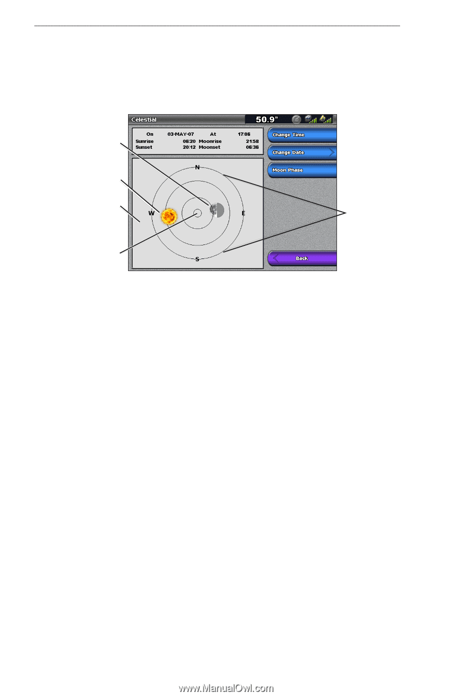
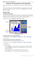
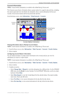
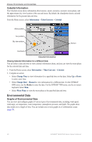
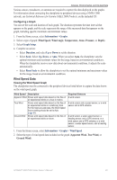
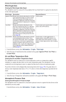
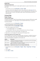
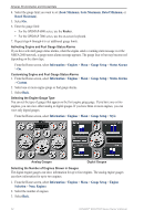
Almanac, Environmental, and On-boat Data Celestial Information The Celestial screen shows information about sunrise, sunset, moonrise, moonset, moon phase, and the approximate sky view location of the sun and moon. By default, the chartplotter shows celestial information for the present date and time. From the Home screen, select Information > Tides/Currents > Celestial. Moon position Sun position Sky view window Horizon Overhead Celestial Information Viewing Celestial Information for a Different Date You can select a date and time to view celestial information about, and you can view the moon phase for the selected date and time. 1. From the Home screen, select Information > Tides/Currents > Celestial. 2. Complete an action: • Select Change Time to view information for a specified time on that date. Select Up or Down to enter a new time. • Select Change Date > Manual to view information for a different date. For the GPSMAP 6000 series, use the Rocker to enter the date. For the GPSMAP 7000 series, use the on-screen keyboard. Select Done. • Select Moon Phase to view the moon phase at the specified date and time. Environmental Data Graphs of Environmental Data You can view and configure graphs of various types of environmental data, including wind speed, wind angle, air temperature, water temperature, atmospheric pressure, and depth. The graphs show data trends over a length of time. You can include one or more graphs in a Combinations screen (page 28). 48 GPSMAP® 6000/7000 Series Owner's Manual
-
 1
1 -
2
-
3
-
4
-
5
-
6
-
7
-
8
-
9
-
10
-
11
-
12
-
13
-
14
-
15
-
16
-
17
-
18
-
19
-
20
-
21
-
22
-
23
-
24
-
25
-
26
-
27
-
28
-
29
-
30
-
31
-
32
-
33
-
34
-
35
-
36
-
37
-
38
-
39
-
40
-
41
-
42
-
43
-
44
-
45
-
46
-
47
-
48
-
 49
49 -
 50
50 -
 51
51 -
 52
52 -
 53
53 -
 54
54 -
 55
55 -
 56
56 -
 57
57 -
 58
58 -
 59
59 -
60
-
61
-
62
-
63
-
64
-
65
-
66
-
67
-
68
-
69
-
70
-
71
-
72
-
73
-
74
-
75
-
76
-
77
-
78
-
79
-
80
-
81
-
82
-
83
-
84
-
85
-
86
-
87
-
88
-
89
-
90
-
91
-
92
-
93
-
94
-
95
-
96
-
97
-
98
-
99
-
100
-
101
-
102
-
103
-
104
-
105
-
106
-
107
-
108
-
109
-
110
-
111
-
112
-
113
-
114
-
115
-
116
-
117
-
118
-
119
-
120
-
121
-
122
-
123
-
124
-
125
-
126
-
127
-
128
-
129
-
130
-
131
-
132
 |
 |