Pioneer AVIC-Z110BT Owner's Manual - Page 45
Customizing the map screen settings
 |
UPC - 012562956404
View all Pioneer AVIC-Z110BT manuals
Add to My Manuals
Save this manual to your list of manuals |
Page 45 highlights
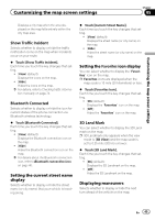
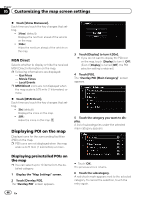
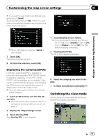
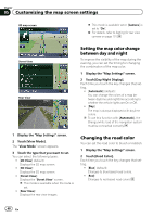
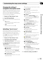
Customizing the map screen settings Chapter 05 Customizing the map screen settings Displays a city map when the area displayed on the map falls entirely within the city map area. Show Traffic Incident Selects whether to display or hide the traffic notification icons on the map when incidents occur on your route. % Touch [Show Traffic Incident]. Each time you touch the key changes that setting. ! [View] (default): Displays the icons on the map. ! [Hide]: Hides the icons on the map. = For details, refer to Checking traffic information manually on page 74. Bluetooth Connected Selects whether to display or hide the icon for current status of the phone connection via Bluetooth wireless technology. % Touch [Bluetooth Connected]. Each time you touch the key changes that setting. ! [View] (default): Displays the Bluetooth connection icon on the map. ! [Hide]: Hides the Bluetooth connection icon on the map. = For details about the Bluetooth connection icon, refer to Bluetooth connection icon on page 40. Setting the current street name display Selects whether to display or hide the street name (or city name) that your vehicle is traveling along. % Touch [Current Street Name]. Each time you touch the key changes that setting. ! [View] (default): Displays the street name (or city name) on the map. ! [Hide]: Hides the street name (or city name) on the map. Setting the Favorites icon display You can select whether to display the "Favorites" icon on the map. p Favorites icons are displayed when the map scale is 10 mile (20 kilometers) or less. % Touch [Favorites Icon]. Each time you touch the key changes that setting. ! [On] (default): Displays the "Favorites" icon on the map. ! [Off]: Hides the "Favorites" icon on the map. 3D Land Mark You can select whether to display the 3D Landmark on the map. p 3D Landmark only appears when the view mode is [3D View] and the map scale is set to 0.25 mile (200 m) or lower. % Touch [3D Land Mark]. Each time you touch the key changes that setting. ! [On] (default): Displays the 3D Landmark on the map. ! [Off]: Hides the 3D Landmark on the map. Displaying maneuvers Selects whether to display or hide the next turn ahead of the vehicle on the map. En 45
-
 1
1 -
2
-
3
-
4
-
5
-
6
-
7
-
8
-
9
-
10
-
11
-
12
-
13
-
14
-
15
-
16
-
17
-
18
-
19
-
20
-
21
-
22
-
23
-
24
-
25
-
26
-
27
-
28
-
29
-
30
-
31
-
32
-
33
-
34
-
35
-
36
-
37
-
38
-
39
-
 40
40 -
 41
41 -
 42
42 -
 43
43 -
 44
44 -
 45
45 -
 46
46 -
 47
47 -
 48
48 -
 49
49 -
 50
50 -
51
-
52
-
53
-
54
-
55
-
56
-
57
-
58
-
59
-
60
-
61
-
62
-
63
-
64
-
65
-
66
-
67
-
68
-
69
-
70
-
71
-
72
-
73
-
74
-
75
-
76
-
77
-
78
-
79
-
80
-
81
-
82
-
83
-
84
-
85
-
86
-
87
-
88
-
89
-
90
-
91
-
92
-
93
-
94
-
95
-
96
-
97
-
98
-
99
-
100
-
101
-
102
-
103
-
104
-
105
-
106
-
107
-
108
-
109
-
110
-
111
-
112
-
113
-
114
-
115
-
116
-
117
-
118
-
119
-
120
-
121
-
122
-
123
-
124
-
125
-
126
-
127
-
128
-
129
-
130
-
131
-
132
-
133
-
134
-
135
-
136
-
137
-
138
-
139
-
140
-
141
-
142
-
143
-
144
-
145
-
146
-
147
-
148
-
149
-
150
-
151
-
152
-
153
-
154
-
155
-
156
-
157
-
158
-
159
-
160
-
161
-
162
-
163
-
164
-
165
-
166
-
167
-
168
-
169
-
170
-
171
-
172
-
173
-
174
-
175
-
176
-
177
-
178
-
179
-
180
-
181
-
182
-
183
-
184
-
185
-
186
-
187
-
188
-
189
-
190
-
191
-
192
-
193
-
194
-
195
-
196
-
197
-
198
-
199
-
200
-
201
-
202
-
203
-
204
-
205
-
206
-
207
-
208
-
209
-
210
-
211
-
212
-
213
-
214
-
215
-
216
 |
 |