Nokia n95 8gb User Guide - Page 82
Positioning (GPS), About GPS
 |
UPC - 758478012215
View all Nokia n95 8gb manuals
Add to My Manuals
Save this manual to your list of manuals |
Page 82 highlights
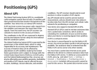
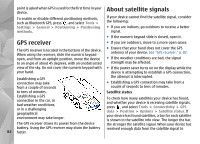
Positioning (GPS) About GPS conditions. The GPS receiver should only be used outdoors to allow reception of GPS signals. The Global Positioning System (GPS) is a worldwide radio navigation system that includes 24 satellites and their ground stations that monitor the operation of the satellites. Your device has an internal GPS receiver. Any GPS should not be used for precise location measurement, and you should never rely solely on location data from the GPS receiver and cellular radio networks for positioning or navigation. A GPS terminal receives low-power radio signals from the satellites and measures the travel time of the signals. From the travel time, the GPS receiver can calculate its location to the accuracy of meters. The coordinates in the GPS are expressed in degrees and decimal degrees format using the international WGS-84 coordinate system. The Global Positioning System (GPS) is operated by the government of the United States, which is solely responsible for its accuracy and maintenance. The accuracy of location data can be affected by Your device also supports Assisted GPS (A-GPS). Assisted GPS (A-GPS) is used to retrieve assistance data over a packet data connection, which assists in calculating the coordinates of your current location when your device is receiving signals from satellites. A-GPS is a network service. Your device is preconfigured to use the Nokia A-GPS service, if no service provider specific A-GPS settings are available. The assistance data is retrieved from the Nokia A-GPS service server only when needed. adjustments to GPS satellites made by the United You must have a packet data internet access point States government and is subject to change with the defined in the device to retrieve assistance data from United States Department of Defense civil GPS policy and the Federal Radionavigation Plan. Accuracy can also be affected by poor satellite geometry. Availability the Nokia A-GPS service. To define an access point for A-GPS, press , and select Tools > Settings > General > Positioning > Positioning server > and quality of GPS signals may be affected by your Access point. A wireless LAN access point cannot be location, buildings, natural obstacles, and weather used for this service. The packet data internet access 81
-
 1
1 -
2
-
3
-
4
-
5
-
6
-
7
-
8
-
9
-
10
-
11
-
12
-
13
-
14
-
15
-
16
-
17
-
18
-
19
-
20
-
21
-
22
-
23
-
24
-
25
-
26
-
27
-
28
-
29
-
30
-
31
-
32
-
33
-
34
-
35
-
36
-
37
-
38
-
39
-
40
-
41
-
42
-
43
-
44
-
45
-
46
-
47
-
48
-
49
-
50
-
51
-
52
-
53
-
54
-
55
-
56
-
57
-
58
-
59
-
60
-
61
-
62
-
63
-
64
-
65
-
66
-
67
-
68
-
69
-
70
-
71
-
72
-
73
-
74
-
75
-
76
-
 77
77 -
 78
78 -
 79
79 -
 80
80 -
 81
81 -
 82
82 -
 83
83 -
 84
84 -
 85
85 -
 86
86 -
 87
87 -
88
-
89
-
90
-
91
-
92
-
93
-
94
-
95
-
96
-
97
-
98
-
99
-
100
-
101
-
102
-
103
-
104
-
105
-
106
-
107
-
108
-
109
-
110
-
111
-
112
-
113
-
114
-
115
-
116
-
117
-
118
-
119
-
120
-
121
-
122
-
123
-
124
-
125
-
126
-
127
-
128
-
129
-
130
-
131
-
132
-
133
-
134
-
135
-
136
-
137
-
138
-
139
-
140
-
141
-
142
-
143
-
144
-
145
-
146
-
147
-
148
-
149
-
150
-
151
-
152
-
153
-
154
-
155
-
156
-
157
-
158
-
159
-
160
-
161
-
162
-
163
 |
 |