Samsung SGH-T879 User Manual Ver.lg2_f2 (English(north America)) - Page 199
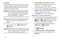
Latitude Options, Send sharing requests, MAP VIEW, Clear Map, Traffic, Satellite, Terrain
 |
View all Samsung SGH-T879 manuals
Add to My Manuals
Save this manual to your list of manuals |
Page 199 highlights
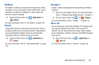
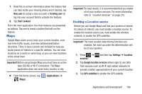
5. Tap Yes at the Send sharing requests prompt. Your friend will receive an email or text message with your location marked on a map. They will also receive instructions on how to view your location from the web or use Latitude on their phone or tablet provided it is available. Once they acknowledge your request, their location will display on your device. They can share their location from their computer, phone, or tablet. For more information, go to http://www.google.com/latitude. 6. To view the map, tap MAP VIEW. Latitude Options Ⅲ From the Latitude map screen ( /DWLWXGH is shown in the upper-left) display, select either: • FRIENDS LIST: allows you to access and edit your current Freinds list. - or - From the Latitude map screen, press one of the following: and select • Clear Map: allows you to remove all markings and layers from the map. • Search: allows you to search for a place of interest. • Directions: displays navigation directions to a location from a starting point. • Layers: allows you to switch map views: - Traffic: (available only in selected areas) Real-time traffic conditions are displayed over roads as color-coded lines. Each color represents how fast the traffic is moving. - Satellite: Maps uses the same satellite data as Google Earth. Satellite images are not real-time. Google Earth acquires the best imagery available, most of which is approximately one to three years old. - Terrain: combines a topographical view of the area's terrain with the current map location. - Transit Lines: displays the overlapping transit lines on your map. - Latitude: allows you to see your friend's locations and share your location with them. - My Maps: displays a list of your preferred maps. - Bicycling: displays the overlapping cycling trails on your map. - Wikipedia: displays any Wikipedia markers and info on your map. Applications and Development 194
-
 1
1 -
2
-
3
-
4
-
5
-
6
-
7
-
8
-
9
-
10
-
11
-
12
-
13
-
14
-
15
-
16
-
17
-
18
-
19
-
20
-
21
-
22
-
23
-
24
-
25
-
26
-
27
-
28
-
29
-
30
-
31
-
32
-
33
-
34
-
35
-
36
-
37
-
38
-
39
-
40
-
41
-
42
-
43
-
44
-
45
-
46
-
47
-
48
-
49
-
50
-
51
-
52
-
53
-
54
-
55
-
56
-
57
-
58
-
59
-
60
-
61
-
62
-
63
-
64
-
65
-
66
-
67
-
68
-
69
-
70
-
71
-
72
-
73
-
74
-
75
-
76
-
77
-
78
-
79
-
80
-
81
-
82
-
83
-
84
-
85
-
86
-
87
-
88
-
89
-
90
-
91
-
92
-
93
-
94
-
95
-
96
-
97
-
98
-
99
-
100
-
101
-
102
-
103
-
104
-
105
-
106
-
107
-
108
-
109
-
110
-
111
-
112
-
113
-
114
-
115
-
116
-
117
-
118
-
119
-
120
-
121
-
122
-
123
-
124
-
125
-
126
-
127
-
128
-
129
-
130
-
131
-
132
-
133
-
134
-
135
-
136
-
137
-
138
-
139
-
140
-
141
-
142
-
143
-
144
-
145
-
146
-
147
-
148
-
149
-
150
-
151
-
152
-
153
-
154
-
155
-
156
-
157
-
158
-
159
-
160
-
161
-
162
-
163
-
164
-
165
-
166
-
167
-
168
-
169
-
170
-
171
-
172
-
173
-
174
-
175
-
176
-
177
-
178
-
179
-
180
-
181
-
182
-
183
-
184
-
185
-
186
-
187
-
188
-
189
-
190
-
191
-
192
-
193
-
 194
194 -
 195
195 -
 196
196 -
 197
197 -
 198
198 -
 199
199 -
 200
200 -
 201
201 -
 202
202 -
 203
203 -
 204
204 -
205
-
206
-
207
-
208
-
209
-
210
-
211
-
212
-
213
-
214
-
215
-
216
-
217
-
218
-
219
-
220
-
221
-
222
-
223
-
224
-
225
-
226
-
227
-
228
-
229
-
230
-
231
-
232
-
233
-
234
-
235
-
236
-
237
-
238
-
239
-
240
-
241
-
242
-
243
-
244
-
245
-
246
-
247
-
248
-
249
-
250
-
251
-
252
-
253
-
254
-
255
-
256
-
257
-
258
-
259
-
260
-
261
-
262
-
263
-
264
-
265
-
266
-
267
-
268
-
269
-
270
-
271
-
272
-
273
-
274
-
275
-
276
-
277
-
278
-
279
-
280
-
281
-
282
-
283
-
284
-
285
-
286
-
287
-
288
-
289
-
290
-
291
-
292
-
293
-
294
-
295
-
296
-
297
-
298
-
299
-
300
-
301
-
302
-
303
-
304
-
305
-
306
-
307
-
308
-
309
-
310
-
311
-
312
-
313
-
314
-
315
-
316
-
317
-
318
-
319
-
320
-
321
-
322
-
323
-
324
-
325
-
326
-
327
-
328
-
329
-
330
-
331
-
332
-
333
-
334
-
335
-
336
-
337
-
338
-
339
-
340
-
341
-
342
-
343
-
344
-
345
-
346
-
347
-
348
-
349
-
350
-
351
-
352
-
353
-
354
-
355
-
356
-
357
-
358
-
359
-
360
-
361
-
362
-
363
-
364
-
365
-
366
-
367
-
368
-
369
 |
 |