Pioneer AVIC-D3 Owner's Manual - Page 160
Route highlighting, Tracking, Types of the Road Stored in the, Roads included in the route, guidance - review
 |
UPC - 012562844169
View all Pioneer AVIC-D3 manuals
Add to My Manuals
Save this manual to your list of manuals |
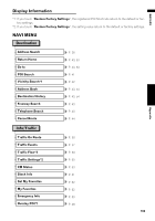
Page 160 highlights
NAVI/AV Route highlighting • Once set, the route is highlighted in bright green or light blue on the map. • The immediate vicinity of your starting point and destination may not be highlighted, and neither will areas with particularly complex road layouts. Consequently, the route may appear to be cut off on the display, but voice guidance will continue. Roads not used in calculations Even though displayed onscreen, the following roads are not included in route calculations. • Stubble roads • Walkways • Roads for public vehicles only • Non routable road Tracking • Your navigation system marks your course on the map in certain increments. This is called tracking. It is handy when you want to check a route traveled without guidance or if returning along a complex route. • A maximum of about 145 miles (230 km) is marked and, as you travel beyond this limit, tracking marks are erased, starting with the oldest. The tracking display shows about 100 miles of vehicle tracking with white dots. ➲ Tracking can also be set to erase automatically whenever the navigation system is switched off ➞ Page 74 the map (only the arrival guidance for the destination or a way point is available). Please review and obey all local traffic rules along the highlighted route. (For your safety.) No turn-by-turn directions or arrow icons will be displayed on these roads. When your vehicle reaches to the entrance of this road, the icon will be displayed, indicating that guidance is not available for this type of road. The icon will be indicated for the road with which the guidance is available. The Close-up of Junction function, Auto Reroute function, Changing the view to Guide View, or Route View are not available. Non routable roads (pink color road) Map display is possible, but it cannot be used for route calculation. Please review and obey all local traffic rules along this route. (For your safety.) Appendix Types of the Road Stored in the Disc There are three types of roads marked on the map of this disc. Roads included in the route guidance and roads not included Turn by Turn Routable Roads contain full attribute data and can be used for full Route Guidance. Pioneer navigation will display full route guidance, including turn-by-turn voice directions and arrow icons. Routable roads (routes displayed and highlighted in purple) have only basic data and can only be used to plot a navigable route. Pioneer navigation will only display a navigable route on 158
-
 1
1 -
2
-
3
-
4
-
5
-
6
-
7
-
8
-
9
-
10
-
11
-
12
-
13
-
14
-
15
-
16
-
17
-
18
-
19
-
20
-
21
-
22
-
23
-
24
-
25
-
26
-
27
-
28
-
29
-
30
-
31
-
32
-
33
-
34
-
35
-
36
-
37
-
38
-
39
-
40
-
41
-
42
-
43
-
44
-
45
-
46
-
47
-
48
-
49
-
50
-
51
-
52
-
53
-
54
-
55
-
56
-
57
-
58
-
59
-
60
-
61
-
62
-
63
-
64
-
65
-
66
-
67
-
68
-
69
-
70
-
71
-
72
-
73
-
74
-
75
-
76
-
77
-
78
-
79
-
80
-
81
-
82
-
83
-
84
-
85
-
86
-
87
-
88
-
89
-
90
-
91
-
92
-
93
-
94
-
95
-
96
-
97
-
98
-
99
-
100
-
101
-
102
-
103
-
104
-
105
-
106
-
107
-
108
-
109
-
110
-
111
-
112
-
113
-
114
-
115
-
116
-
117
-
118
-
119
-
120
-
121
-
122
-
123
-
124
-
125
-
126
-
127
-
128
-
129
-
130
-
131
-
132
-
133
-
134
-
135
-
136
-
137
-
138
-
139
-
140
-
141
-
142
-
143
-
144
-
145
-
146
-
147
-
148
-
149
-
150
-
151
-
152
-
153
-
154
-
 155
155 -
 156
156 -
 157
157 -
 158
158 -
 159
159 -
 160
160 -
 161
161 -
 162
162 -
 163
163 -
 164
164 -
 165
165 -
166
-
167
-
168
-
169
-
170
-
171
-
172
-
173
 |
 |
