Garmin GPSMAP 296 Pilot's Guide - Page 82
Viewing the Waypoint on the Map, Measure Distance, Point to on Main Map
 |
View all Garmin GPSMAP 296 manuals
Add to My Manuals
Save this manual to your list of manuals |
Page 82 highlights
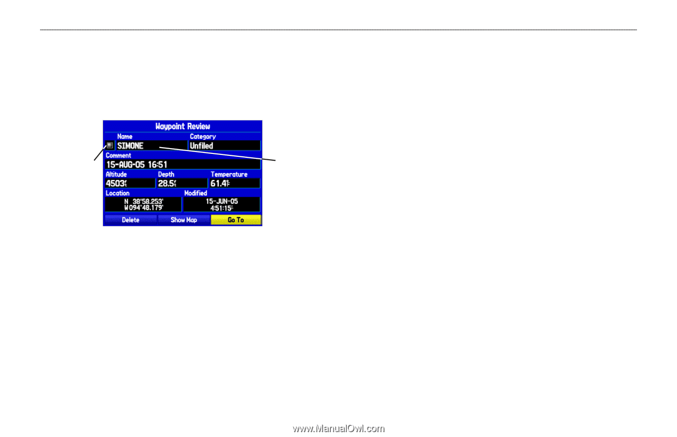
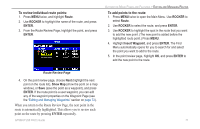
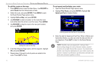
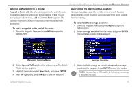
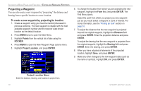
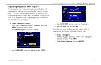
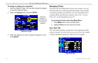
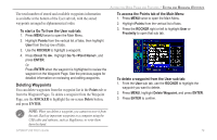
AUTOMOTIVE MODE PAGES AND FEATURES > EDITING AND MANAGING WAYPOINTS To change the waypoint name: 1. Open the Waypoint Review or Waypoint Edit Page. 2. Highlight the waypoint name field, and press ENTER. 3. Use the ROCKER to enter a new name, and press ENTER when done. To edit the next waypoint in the list: 1. After you have edited the waypoint on the Waypoint Edit Page, highlight Next, and press ENTER. 2. The Waypoint list appears with the next waypoint highlighted. Press ENTER to edit that waypoint. Symbol field Name field Waypoint Review Page To change the waypoint symbol or other element: 1. Open the Waypoint Review or Waypoint Edit Page. 2. Highlight the waypoint symbol field to the left of the waypoint name or highlight another field you want to change, and press ENTER. 3. Use the ROCKER to select the symbol or enter data, and press ENTER. Viewing the Waypoint on the Map Use the Waypoint Page menu to view the waypoint on the map and measure distance. To view the waypoint on the map: 1. From the Waypoint Page, highlight Show Map. 2. Press ENTER. The waypoint is highlighted on a map with an information window at the top that shows the waypoint name, location and distance and bearing from your current location. On the Show Map screen, two additional options are available by pressing MENU: Measure Distance-allows you to measure the distance and bearing between two points on the map (see page 32 for more information). Point to on Main Map-returns to the highlighted waypoint on the Map Page and exits the Waypoint Page. 74 GPSMAP 296 Pilot's Guide
-
 1
1 -
2
-
3
-
4
-
5
-
6
-
7
-
8
-
9
-
10
-
11
-
12
-
13
-
14
-
15
-
16
-
17
-
18
-
19
-
20
-
21
-
22
-
23
-
24
-
25
-
26
-
27
-
28
-
29
-
30
-
31
-
32
-
33
-
34
-
35
-
36
-
37
-
38
-
39
-
40
-
41
-
42
-
43
-
44
-
45
-
46
-
47
-
48
-
49
-
50
-
51
-
52
-
53
-
54
-
55
-
56
-
57
-
58
-
59
-
60
-
61
-
62
-
63
-
64
-
65
-
66
-
67
-
68
-
69
-
70
-
71
-
72
-
73
-
74
-
75
-
76
-
 77
77 -
 78
78 -
 79
79 -
 80
80 -
 81
81 -
 82
82 -
 83
83 -
 84
84 -
 85
85 -
 86
86 -
 87
87 -
88
-
89
-
90
-
91
-
92
-
93
-
94
-
95
-
96
-
97
-
98
-
99
-
100
-
101
-
102
-
103
-
104
-
105
-
106
-
107
-
108
-
109
-
110
-
111
-
112
-
113
-
114
-
115
-
116
-
117
-
118
-
119
-
120
-
121
-
122
-
123
-
124
-
125
-
126
-
127
-
128
-
129
-
130
-
131
-
132
-
133
-
134
-
135
-
136
-
137
-
138
-
139
-
140
-
141
-
142
-
143
-
144
-
145
-
146
-
147
-
148
-
149
-
150
-
151
-
152
-
153
-
154
-
155
-
156
-
157
-
158
-
159
-
160
-
161
-
162
-
163
-
164
-
165
-
166
-
167
-
168
 |
 |