Pioneer AVIC-X850BT Operation Manual - Page 31
Types of the road stored in, the map database, Operating the map screen, How to use the map - review
 |
View all Pioneer AVIC-X850BT manuals
Add to My Manuals
Save this manual to your list of manuals |
Page 31 highlights
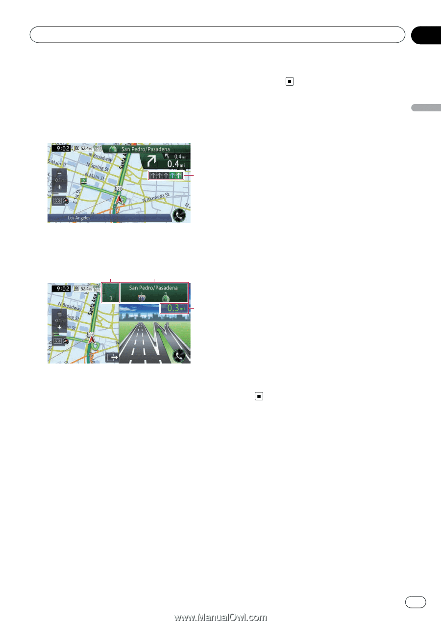
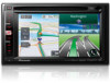
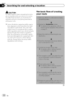
How to use the map Chapter 03 How to use the map The display while driving on the freeway In certain locations of the freeway, lane information is available. The map indicates the recommended lane to be in to easily maneuver the next guidance. 1 While driving on the freeway, freeway exit numbers and freeway signs may be displayed in the vicinity of interchanges and exits. 2 3 4 1 Lane information ! Green lane: Guided lane Green lane with a white arrow: Recommended lane ! Gray lane: Non guided lane p On the toll roads, the lanes are in blue instead of green. 2 Freeway exit information Displays the freeway exit. 3 Freeway signs These show the road number and give directional information. 4 Distance to the next guidance point These show the distance to the next guidance point. p If the data for these items is not contained in the built-in memory, the information is not available even if there are signs on the actual road. Types of the road stored in the map database Roads included in the route guidance Turn-by-turn routable roads contain full attribute data and can be used for full route guidance. Pioneer navigation will display full route guidance, including turn-by-turn voice directions and arrow icons. Roads without turn-by-turn instructions Routable roads (the route displayed and highlighted in pink) have only basic data and can only be used to plot a navigable route. Pioneer navigation will display full route guidance, including turn-by-turn voice directions and arrow icons. Please review and obey all local traffic rules along the highlighted route for your safety. No turn-by-turn directions will be displayed on these roads. Non-routable roads (light gray-color roads) Map display is possible, but cannot be used for route calculation. Please review and obey all local traffic rules along this route. (For your safety.) Operating the map screen Scrolling the map to the position you want to see 1 Display the map screen. = For details of the operations, refer to How to use the navigation menu screens on page 22. 2 Touch and hold the map in the desired direction to see. The map moves centered around the position you have touched. En 31
-
 1
1 -
2
-
3
-
4
-
5
-
6
-
7
-
8
-
9
-
10
-
11
-
12
-
13
-
14
-
15
-
16
-
17
-
18
-
19
-
20
-
21
-
22
-
23
-
24
-
25
-
 26
26 -
 27
27 -
 28
28 -
 29
29 -
 30
30 -
 31
31 -
 32
32 -
 33
33 -
 34
34 -
 35
35 -
 36
36 -
37
-
38
-
39
-
40
-
41
-
42
-
43
-
44
-
45
-
46
-
47
-
48
-
49
-
50
-
51
-
52
-
53
-
54
-
55
-
56
-
57
-
58
-
59
-
60
-
61
-
62
-
63
-
64
-
65
-
66
-
67
-
68
-
69
-
70
-
71
-
72
-
73
-
74
-
75
-
76
-
77
-
78
-
79
-
80
-
81
-
82
-
83
-
84
-
85
-
86
-
87
-
88
-
89
-
90
-
91
-
92
-
93
-
94
-
95
-
96
-
97
-
98
-
99
-
100
-
101
-
102
-
103
-
104
-
105
-
106
-
107
-
108
-
109
-
110
-
111
-
112
-
113
-
114
-
115
-
116
-
117
-
118
-
119
-
120
-
121
-
122
-
123
-
124
-
125
-
126
-
127
-
128
-
129
-
130
-
131
-
132
-
133
-
134
-
135
-
136
-
137
-
138
-
139
-
140
-
141
-
142
-
143
-
144
-
145
-
146
-
147
-
148
-
149
-
150
-
151
-
152
-
153
-
154
-
155
-
156
-
157
-
158
-
159
-
160
-
161
-
162
-
163
-
164
-
165
-
166
-
167
-
168
-
169
-
170
-
171
-
172
-
173
-
174
-
175
-
176
-
177
-
178
-
179
-
180
-
181
-
182
-
183
-
184
-
185
-
186
-
187
-
188
-
189
-
190
-
191
-
192
-
193
-
194
-
195
-
196
-
197
-
198
-
199
-
200
-
201
-
202
-
203
-
204
 |
 |